

Olkhon Island
Sites
- The main settlement of the island is Khuzhir the population of which is about 1200 people. There is an orthodox church, the Museum of Local History, and the Museum of Needlework. There is also the largest on Lake Baikal Malomorsky Fish Factory.
- One of nine holy places of Asia – Cape Burkhan (Rock Shamanka) is located near Khuzhir. Earlier it was called “Rock-Temple”. Photographers and producers use images of this place to illustrate the beauty of Lake Baikal. The white marble double-peak rock of the cape covered with bright red lichens has a through cave worshiped by Buryats. Various shaman rites and offering sacrifices were conducted here. After the adoption of Lamaism, there was Buddha’s Altar. According to legend, the cave is an earth castle of Ezhin (or Burkhan) – the owner of Olkhon. Nobody except shamans has a right to approach the residence of spirit.
- Bays with clear water are situated some minutes’ walk to the north of Khuzhir. One of the warmest and beautiful sandy beaches is a beach of Saraisky Bay surrounded by pines stretching for 3 km from Cape Burkhan to settlement Kharantsy.
- The largest in area sandy deposits of the western coast of Lake Baikal are located on the island. Dunes of Peschanoye Urochishche (district) situated 20 km to the north off Khuzhir in Nyurganskaya Bay occupy about 3 km
2. Their origin is attributed to constantly blowing winds from the lake. They transfer sand from the shore and form picturesque hills and crests. - “White” Cape Sagan-Khushun is situated 4 km off the northern extremity of Olkhon Island. The cape rocks composed of light marble and studded with brown and red patches of lichens were included in the list of natural monuments of Lake Baikal. This rock assemblage is about 1 km long. A group of rocks in the southern part of the cape is known with the locals as “Three brothers”. It consists of three spectacular rocks-pyramids with a cave and grottos one of which is rather large for entering it by boat. Cape Sagan-Khushun is also famous for its barely visible path coming down to the water which is a rare thing for the northern part of the island.
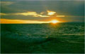
- An unforgettable view of Lake Baikal is opened from Cape Khoboy (in the Buryat language it means “fang”), the northern point of the island. It is especially beautiful at sunrise. The pillared rock on the cape looks like a sharp fang, whereas from the lake side it resembles a woman’s profile with a clear-cut head, nose, chin, and breast. The local name of the cliff is Maiden. According to legend, this is a stony Buryat woman who out of envy asked the God for a castle which had been given to her husband – a shaman. Gods became angry and turned her into a rock saying “You shall be a rock till there is envy and evil”. You can hear a many-voiced echo while crying reflected from the monolithic rock. In winter and spring grottos look very fascinating decorated with splashes of ice and icicles.
- Uzury is the first from Cape Khoboy sloping dale coming to the eastern coast. This is the only place in the north of Olkhon Island where the motor road comes to the water. There is a meteorological station on the coast of the bay in Uzury. If you hike from here, after climbing the mountain in 1.5-2 hours there opens a magnificent view of Lake Baikal (the north of Olkhon and Maloye More) which takes your breath.
- The highest point of the island is a sacred Mount Zhima surrounded by numerous beliefs. The area of Izhimey where the mount is situated derived from the word “ezhin” which means an owner of the area. Ancient myths tell about thunder god Ugute-noyon, the Sky’s son, who decided to settle close to the famous Olkhon shaman Nagre-bo and his wife Zagre-Khatan. But then he changed his mind and decided to live in the cave Burkhan giving this castle on Izhimey to the shaman couple. Together with him lived a huge immortal bear chained by his former owner-celestial and left in the cave for guarding his properties. From the earliest times among Olkhon Buryats there was a ban on climbing the top of Zhima, as well as on visiting the shaman wood – a relict spruce forest which has been preserved since the Ice Age. There is also a legend about the mount spirit – an old man with a long white beard who helped not once lost children on the cape slope to find a way home.
- Steppe Cape Khorgoy (the turn from the road at settlement Khaday) is known for its wall ruins of the ancient fort crossing the cape in its narrowest part (it was found by I. Chersky in 1879). Such walls are likely to have served as fortified constructions against nomads or as separation between public and sacral space where spirits and gods lived. For example, at Cape Shibetey burials of people were found behind the wall in a form of a mound covered with stony plates. Historians believe that settlements-sanctuaries and mounds were constructed by kurykans – an ancient Turkic nationality living in Pribaikalye in the VI-XI centuries.
- Olkhon Island has its own lakes the most famous of which are Khankhoy, Nurskoye, Shara-Nur, and Nuku-Nur. Lake Khankhoy or Kholoy-Nur (“kholoy” in the Buryat language means throat, and “nur” – lake) overgrown by algae almost to the bottom is considered to be the best place for fishing with Siberian roach, perch and pike (sometimes pike may be of over 10 kg!), as well as for excursions – there are a lot of archaeological monuments nearby. Lake Nurskoye overgrown with pondweed connected with Zagli Bay is well warmed up in summer. However, its water is not so clear as in Lake Baikal because of its slimy bottom. Saline Lake Shara-Nur (Yellow Lake) famous for its medicinal characteristics (the mud helps cure arthritis and other diseases) is the only lake on Olkhon Island with mineralized water. Lake Nuku-Nur is like a rock crater filled with very warm water in which it is almost impossible to bathe because of the abundance of fishes and other lake living creatures.

Copyright © 2005-2010 ЦНИТ ИГУ, 
Дизайн web-студия ЦНИТ ИГУ